home

[ Content | Sidebar ]

Nobelparken in Stockholm 🇸🇪

February 7th, 2021

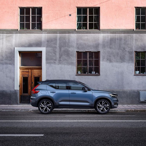
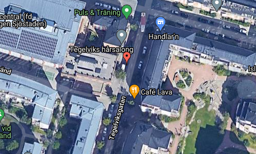
Volvo Photo Locations Part 359
Historic Volvo Photography Locations Overview
bookmark www.volvophotolocations.com today!

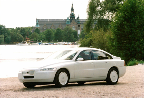
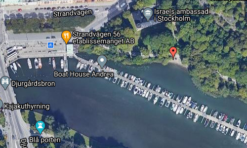
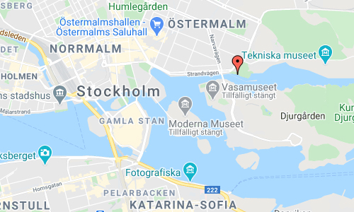
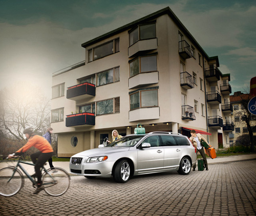
1992 – Volvo ECC Environmental Concept Car at Nobelparken with view on Nordiska Museet in Stockholm, Sweden 🇸🇪. (photography by Lennart Nygren)

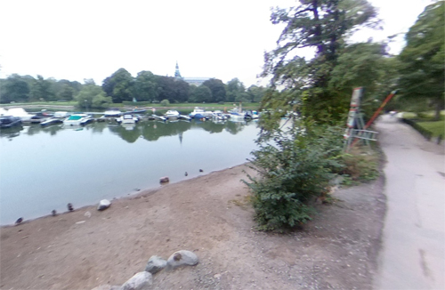
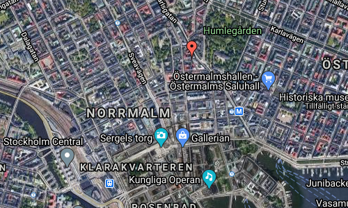
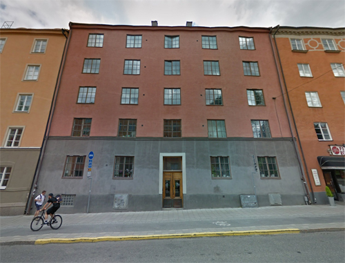
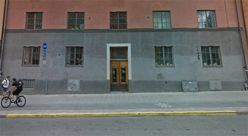
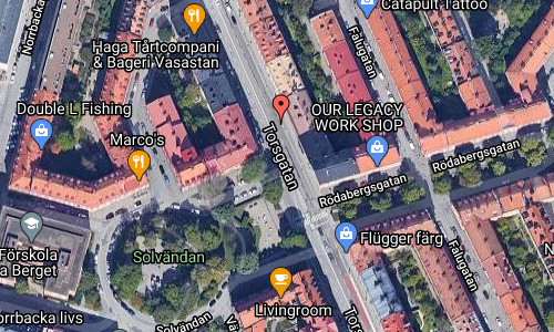
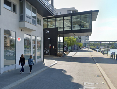
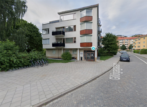
2021 – Nobelparken with (minimal) view on Nordiska museet in Stockholm (Google Streetview)

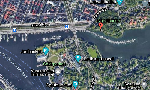
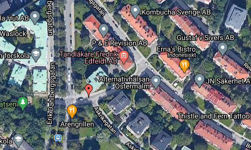
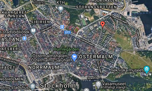
The Nobel Park is a park on Östermalm in Stockholm’s inner city that is part of the Kungliga nationalstadsparken (Royal National City Park). To the east of the park, the exclusive residential area Diplomatstaden connects. In the park there were several monumental construction projects, which, however, were never completed. The Nobel Park got its current name in 1912.

The Volvo ECC (Environmental Concept Car) was an executive luxury concept car built by Volvo in 1992. It was a design exercise in using recycled material and hybrid technology. It was powered by a hybrid electric and gas turbine engine. Many of its lines and general styling were used as inspiration for the first generation Volvo S80. The ECC set a new design language for future Volvo models from the S80 onwards, the most obvious styling feature being the stepped waistline, which was inspired by the similar feature on the 200 Series, whilst retaining some of the angular elements from the 700/900 ranges.

More information at sv.wikipedia.org and media.volvocars.com.

Volvo Photo Locations

Finlandshuset on Snickarbacken in Stockholm 🇸🇪

February 7th, 2021

Volvo Photo Locations Part 358
Historic Volvo Photography Locations Overview
bookmark www.volvophotolocations.com today!

2018 – Volvo V60 Inscription at Snickarbacken in Stockholm, Sweden 🇸🇪.

2018 – Volvo V60 Inscription at Snickarbacken in Stockholm, Sweden 🇸🇪.

2021 – Finlandshuset on Snickarbacken in Stockholm (Google Streetview)

2021 – Finlandshuset on Snickarbacken in Stockholm (Google Streetview)

Snickarbacken is a short street in the Norrmalm district of Stockholm that runs between Birger Jarlsgatan in the east via a staircase to Regeringsgatan in the west.

The street was formerly called Bödelnsbacken. In 1882, the homeowners at Bödelsbacken applied for the street name to be changed to Snickaregatan, which was approved and in 1900 was changed to Snickarebacken. In 1921, the name was changed to Snickarbacken without an “e” in the middle.

The Finnish Institute’s beautiful house at Snickarbacken 2-4 in central Stockholm is just over 100 years old. It was built in 1896 for the KFUM (YMCA). The decorations were lavish both interior and exterior. And parts of the house are today k-marked, for example the multi-colored limestone floors of the stairwells and the stylish fireplace in the gallery.

In 1970, the house was bought by the Finnish House Foundation, which in 1995 was transformed into the Finnish Cultural Institute Foundation in Sweden, which today runs the Finnish Institute. In 1995, the neighboring property with Hotell Karelia was also sold, and in the autumn, the board announced an architectural competition for a complete renovation of the house. The winner was GWSK Arkitekter in Stockholm.

The property comprises six floors, two of which are below street level. The building houses the Finnish Institute’s premises, library, reading room, exhibition hall / gallery and a conservatory adjacent to the reception. The house also houses the Finnish Association in Stockholm. The property is handicapped accessible.

The Finnish Institute inaugurated its new beautiful sauna and three new conference rooms in March 2004.

CD – All Jazzed Up and Ready to Move with music for Volvo V60.

More information at sv.wikipedia.org and finlandsinstitutet.se.

Volvo Photo Locations

Torsgatan in Stockholm 🇸🇪

February 7th, 2021

Volvo Photo Locations Part 357
Historic Volvo Photography Locations Overview
bookmark www.volvophotolocations.com today!

2018 – Volvo XC40 R-Design at Torsgatan in Stockholm Sweden 🇸🇪.

2018 – Volvo XC40 R-Design at Torsgatan in Stockholm Sweden 🇸🇪.

2018 – Volvo XC40 R-Design at Torsgatan in Stockholm Sweden 🇸🇪.

2018 – Volvo XC40 R-Design with snow at Torsgatan in Stockholm Sweden 🇸🇪.

2018 – Volvo XC40 R-Design at Torsgatan in Stockholm Sweden 🇸🇪.

2021 – Torsgatan 70 in Stockholm (Google Streetview)

2021 – Torsgatan 70 in Stockholm (Google Streetview)

Torsgatan is a street located in Vasastan in Stockholm, Sweden.

Torsgatan is a main street in the districts of Norrmalm and Vasastaden in Stockholm’s inner city.

Torsgatan got its current name at the major name revision in 1885 and the name was under the category “the Nordic theology”, where Tor was one of the foremost in the Nordic deity saga. During the name revision, the street was described as “the road to Rörstrand from the northern railway station past Sabbatsberg and Atlas and further north”. In addition to Sabbatsberg Hospital, Mjölkcentralen had its main dairy here in the 1930s and 1940s.

At Torsgatan, there is also Bonnierhuset and Bonniers konsthall as well as SPP Livförsäkring’s head office. The largest building along Torsgatan is the facility that was built for Stockholm’s gasworks and Stockholm’s water pipeline between the years 1903 to 1906 according to the architects Ferdinand Boberg’s and Gustaf de Frumerie’s drawings.

Stockholm’s first asphalt street was completed in 1910. It was the Asphalt and Cement Company that provided part of Torsgatan – in the middle of the then “small plantation” at Norra Bantorget – with a modern paving at no cost.

More information at sv.wikipedia.org.

Volvo Photo Locations

Hammarby kaj in Stockholm 🇸🇪

February 6th, 2021

Volvo Photo Locations Part 356
Historic Volvo Photography Locations Overview
bookmark www.volvophotolocations.com today!

2016 - Volvo V60 at Texas Longhorn on Hammarby kaj in Hammarby Sjöstad, Stockholm

2016 – Volvo V60 at Texas Longhorn on Hammarby kaj in Hammarby Sjöstad, Stockholm, Sweden 🇸🇪.

2021 – Hammarby kaj in Stockholm (Google Streetview)

Texas Longhorn is a restaurant locatd on Hammarby kaj in Hammarby Sjöstad, Stockholm, Sweden.

Hammarby Sjöstad is a part of the inner city of Stockholm, currently undergoing major urban redevelopment. It is located on both sides of lake Hammarby Sjö, bordering Nacka Municipality to the east.

Before the current redevelopment began, the area was known as Norra Hammarbyhamnen and Södra Hammarbyhamnen, a mainly industrial zone, centered on the Lumafabriken works, a piece of functionalist architecture designed by Eskil Sundahl and Arthur von Schmalensee, which now houses a library and offices. The neighbouring Lugnet was a run-down light industrial area, not intended to be permanent, housing an impromptu trailer park. On the north side of the lake, the Norra Hammarbyhamnen area was used as a harbour area, with a railway connecting the area.

New plans for most of the Södermalm area Norra Hammarbyhamnen in the early 1990s opened the door for a redevelopment of the entire area around the water expanse Hammarby Sjö. A general plan, featuring an extension of the Tvärbanan light rail link from Gullmarsplan through the area was presented.

Although the south and east part of Hammarby Sjöstad is located outside what is traditionally considered to be the perimeter of inner-city Stockholm, the design is intentionally semi-urban rather than suburban, with boulevards, somewhat defined and architecturally varied city blocks, and commercial spaces in the ground floor of some buildings. The location, next to the lake Hammarby Sjö and a canal, Sickla Kanal, has allowed for plenty of quays and walkways along the water.

More information at sv.wikipedia.org and texaslonghorn.se.

Volvo Photo Locations

Barnängsfabriken on Tegelviksgatan in Stockholm 🇸🇪

February 6th, 2021

Volvo Photo Locations Part 355
Historic Volvo Photography Locations Overview
bookmark www.volvophotolocations.com today!

2015 - Volvo XC60, somewhere in Göteborg?

2015 – Volvo XC60 at (former) Barnängsfabriken on Tegelviksgatan on Södermalm in Stockholm, Sweden 🇸🇪.

2015 – Volvo XC60 at (former) Barnängsfabriken on Tegelviksgatan on Södermalm in Stockholm, Sweden 🇸🇪.

2015 – Volvo XC60 at (former) Barnängsfabriken on Tegelviksgatan on Södermalm in Stockholm, Sweden 🇸🇪.

2021 – Barnängsfabriken on Tegelviksgatan in Stockholm (Google Streetview)

2021 – Barnängsfabriken on Tegelviksgatan in Stockholm (Google Streetview)

2021 – Barnängsfabriken on Tegelviksgatan in Stockholm

Barnängsfabriken is located on Tegelviksgatan on Södermalm in Stockholm, Sweden.

Here was located Stockholms Bomullsspinneri och Väfveri AB, later STOBO, a company that produced cotton yarn, cotton, volagne and silk fabrics, tarpaulins, socks, knitwear and more.

The company was founded in 1869. The company operated on Barnängen on Södermalm from 1869 until 1952. The Barnängsfabriken operated cotton spinning, weaving, silk weaving and preparation work. The company had a dyeing, bleaching and knitwear factory in Liljeholmen.

In 1952, the business at Barnängen was closed down and the cotton spinning business was moved to the Torshags factory while a new silk weaving mill was started in Sölvesborg.

Today, light company Fagerhult is located on the premises.

More information at sv.wikipedia.org and sparbossan.se.

Volvo Photo Locations

Eataly Stockholm on Biblioteksgatan in Stockholm 🇸🇪

February 6th, 2021

Volvo Photo Locations Part 354
Historic Volvo Photography Locations Overview
bookmark www.volvophotolocations.com today!

2008 - Volvo C30 Drive at Eataly on Biblioteksgatan in Stockholm, Sweden

2008 – Volvo C30 Drive at Eataly on Biblioteksgatan in Stockholm, Sweden 🇸🇪. (Photography by Henrik Halvarsson)

2021 – Eataly located in the former cinema on Biblioteksgatan in Stockholm (Google Streetview)

Biblioteksgatan (Swedish for “Library Street”) is a street located on Norrmalm in central Stockholm. The street starts out as a pedestrian street at Norrmalmstorg until it passes Stureplan, whereafter it continues towards Humlegården and the Royal Library.

The street is a well-known shopping street with many luxurious brand stores and some of the highest rent levels for retail in Stockholm.

In 2010 the dominant real estate owner of the area, Hufvudstaden, launched an effort to incorporate the streets crossing Biblioteksgatan in a larger shopping district they want to call Bibliotekstan (“Library Town”). The concept is influenced by a similar campaign in London to expand the shopping street Carnaby Street into a “Carnaby Village”.

Röda Kvarn, on Biblioteksgatan 5, was the second oldest preserved large cinema in Stockholm until it was rebuilt into the Urban Outfitters mall in 2006. The property was built in 1915 by Hufvudstaden AB, which still owns it. Since 2018, the Eataly market hall has been in the premises. This conversion from cinema to restaurant is reversible, ie the premises can be restored to a cinema in the future. No walls have been removed or any new ones have been set up. The cinema seats have been replaced by store shelves. The facade is intact with the original design. Another example of an old cinema that has been converted into a mall is Victoria in Gothenburg.

More information at sv.wikipedia.org and eataly.se.

Volvo Photo Locations

Birger Jarls torg in Stockholm 🇸🇪

February 6th, 2021

Volvo Photo Locations Part 353
Historic Volvo Photography Locations Overview
bookmark www.volvophotolocations.com today!

2008 - Volvo S40 Drive at Birger Jarls torg with Stenbockska palatset and Svea hovrätt in Stockholm, Sweden

2008 – Volvo S40 Drive at Birger Jarls torg with Stenbockska palatset and Wrangelska palatset in Stockholm, Sweden 🇸🇪. (Photography by Henrik Halvarsson)

2021 – Birger Jarls torg in Stockholm (Google Streetview)

Birger Jarls torg is a public square located on Riddarholmen in Gamla stan, the old town in Stockholm, Sweden.

The square used to be called Riddarholmstorget, but was in the mid-19th century renamed Birger Jarls torg after Birger Jarl, traditionally attributed as the founder of Stockholm. A statue of him was erected on the square in 1854. It was designed by Swedish sculptor Bengt Erland Fogelberg (1786–1854).

The square is surrounded by six palaces, today mostly occupied by various governmental authorities. The area is isolated from the rest of the city by the artery traffic route Centralbron. (See Riddarholmen.) Just south of the square is the church Riddarholm Church.

The building on the left is the Stenbockska palatset. On the right you find the Svea hovrätt.

During the years 1840-1851, the Ministry of Land Defence was, like the Ministry for Naval Affairs, located in the Stenbockska palatset at Birger Jarls torg 4.
The Svea hovrätt or Swedish Court of Appeal, is one of six appellate courts in the Swedish legal system. It is located in the Wrangel Palace, on Riddarholmen islet in Gamla Stan.
Wrangel Palace was the official Stockholm residence of the royal family and court from 1697 until 1754, when the Royal Palace of Stockholm was completed. During this time, the Palace was called Kungshuset (The Kings House). From 1756 to 1928, it housed the Statskontoret (Office of state). In 1802, the palace had to be rebuilt once again after a fire. This time the architect was C.G. Gjörwell.

More information at sv.wikipedia.org/wiki/Wrangelska_palatset and v.wikipedia.org/wiki/Birger_Jarls_torg.

Volvo Photo Locations

Gillögagatan in Stockholm 🇸🇪

February 6th, 2021

Volvo Photo Locations Part 352
Historic Volvo Photography Locations Overview
bookmark www.volvophotolocations.com today!

2008 - Volvo V70 at the (former) cinema Gärdet Gillögagatan and Erik Dahlbergsgatan on Gärdet in Stockholm, Sweden

2008 – Volvo V70 at the (former) cinema Gärdet on Gillögagatan and Erik Dahlbergsgatan on Gärdet in Stockholm, Sweden 🇸🇪. (Photography by Henrik Halvarsson)

2021 – Gillögagatan on Gärdet in Stockholm (Google Streetview)

Gillögagatan and Erik Dahlbergsgatan are street on Gärdet in Stockholm, Sweden.

Gärdet is a part of Stockholm, east and northeast of Östermalm. Its official name is Ladugårdsgärdet. It is renowned for its large number of modernist apartments.

Gärdet is one of the largest residential districts built in Stockholm during the 1930s, built from 1929 until around 1950, and houses about 10,000 people. The district includes a vast open space used for recreational purposes; the name Gärdet (“the field”) often refers to this area specifically.

During the summer semester, there are several different events on “the field” such as circus, music and sports and more.

More information at sv.wikipedia.org.

Volvo Photo Locations

Lower Loop Street in Cape Town – SA 🇿🇦

December 12th, 2020

International Volvo Photo Locations Part 457
Historic Volvo Photography Locations Overview
bookmark www.volvophotolocations.com today!

2006 - Volvo S60R and V70R somewhere in Cape Town in South Africa?

2006 – Volvo S60R and V70R on Lower Loop Street with view on Edward Nathan Sonnenbergs House in Cape Town City Centre in South Africa 🇿🇦.

Lower Loop Street with view on Edward Nathan Sonnenbergs House in Cape Town City Centre in South Africa (Google Streetview)

Lower Loop Street is located in Cape Town City Centre in South Africa.

ENSafrica (Edward Nathan Sonnenbergs) is Africa’s largest law firm. ENSafrica currently has over 620 practitioners and was established over 100 years ago. The firm specialises in all commercial areas of Law, Tax, Forensics and IP. The firm is a Level 2 Broad-Based Black Economic Empowerment (BBBEE) contributor. ENSafrica is one of the traditional “Big Five” law firms in South Africa.

More information at en.wikipedia.org and sa-venues.com.

Volvo Photo Locations

Old Marine Drive under Nelson Mandela Blvd in Cape Town – SA 🇿🇦

December 12th, 2020

International Volvo Photo Locations Part 456
Historic Volvo Photography Locations Overview
bookmark www.volvophotolocations.com today!

2006 – Volvo S60R and V70R at Old Marine Drive under Nelson Mandela Blvd in Foreshore Cape Town South Africa 🇿🇦.

2006 – Volvo S60 R at Old Marine Drive under Nelson Mandela Blvd in Foreshore Cape Town South Africa 🇿🇦.

2006 – Volvo V70 R at Old Marine Drive under Nelson Mandela Blvd in Foreshore Cape Town South Africa 🇿🇦.

2020 – Old Marine Drive under Nelson Mandela Blvd in Cape Town (Google Streetview)

Old Marine Drive is next to Foreshore and is located in City of Cape Town, Western Cape, South Africa. Old Marine Drive has a length of 0.41 kilometres.

The Foreshore is an area in Cape Town, South Africa, situated between the historic city centre and the modern Port of Cape Town. It is built on land reclaimed from Table Bay in the 1930s and 1940s in connection with the construction of the Duncan Dock to replace the old harbour. Much of the Foreshore area is occupied by transport infrastructure for the port and Cape Town Railway Station. Other notable buildings in the area are the Cape Town Civic Centre, the Artscape Theatre Centre, and the Cape Town International Convention Centre. When the area was reclaimed, the Government undertook a detailed study (the Szlumper Commission) to decide how to use the land not needed by South African Railways. This resulted in the issuance of a detailed proposal, The Cape Town Foreshore Plan.

More information at en.wikipedia.org and sa-venues.com.

Volvo Photo Locations