home

[ Content | Sidebar ]

Dovercourt Road in Toronto – CAN 🇨🇦

December 6th, 2018

International Volvo Photo Locations Part 334
HOME - Volvo Photo Locations
HOME www.volvophotolocations.com

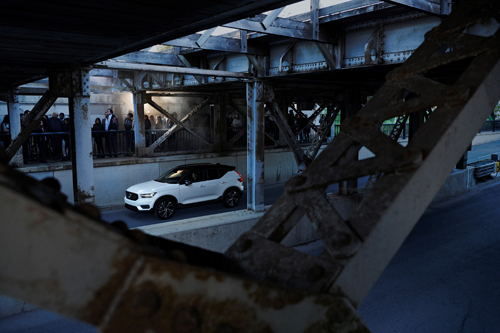
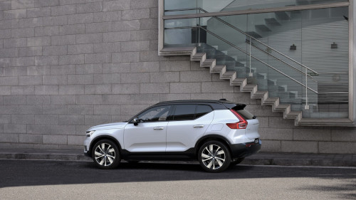
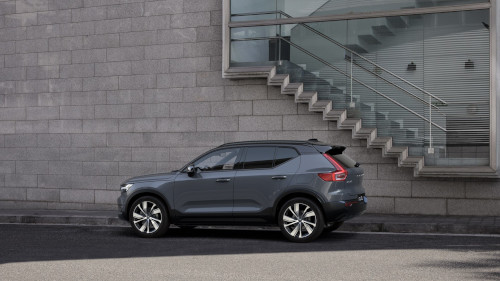
2018 – Volvo XC40 R-Design at Dovercourt Road in Toronto in Canada 🇨🇦
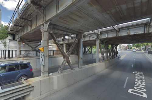
2018 – Dovercourt Road, under the railway in Toronto (Google Streetview)
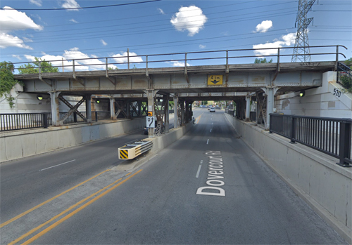
2018 – Dovercourt Road, under the railway in Toronto (Google Streetview)

Dovercourt Road is a street in Toronto, Canada.

Dovercourt Road starts at Davenport Road in Davenport and crosses Dovercourt Park, Bloorcourt Village, Dufferin Groove towards West Queen West where it ends at Sudbury Street.

It crosses the Bloor–Danforth Line knwon as Line 2 Bloor–Danforth is a subway line in the Toronto subway system, operated by the Toronto Transit Commission (TTC). It has 31 stations and is 26.2 kilometers in length. It opened on February 26, 1966, and extensions at both ends were completed in 1968 and again in 1980.

The most travelled part of the line is located in Old Toronto’s midtown area known as Yorkville. In this area, the subway also connects to Line 1 Yonge–University at Spadina, St. George and Yonge stations. Towards the east, the line runs parallel to Danforth Avenue serving areas such as Greektown and the East Danforth, it then continues further to the east through a very short stretch in East York to its eastern terminus in Scarborough, where it connects to Line 3 Scarborough. To the west, the line continues along Bloor Street serving many communities such as The Annex, Bloor West Village, an extremely short stretch in York, and the area surrounding the line’s western terminus located in Etobicoke.

The line runs primarily a few metres north of Bloor Street from its western terminus at Kipling Avenue to the Prince Edward Viaduct east of Castle Frank Road, after which the street continues as Danforth Avenue. Just east of Main Street, the line begins to deviate northeast from Danforth Avenue and runs grade-separated until its eastern terminus, slightly east of Kennedy Road on Eglinton Avenue. The subway line is closed nightly for maintenance, when Blue Night Network bus routes serve the route.

Dovercourt Road takes its name from the once-prominent Denison family, whose land holdings included a stretch of the street. Neither a main thoroughfare nor a sleepy residential enclave, there’s something quintessentially Toronto about Dovercourt. At various points in its history, the street seemed on the brink of becoming more developed, particularly when it was home to a streetcar route, but aside from little hubs of activity at main intersections (notably Queen, Argyle, College, Bloor and Hallam), it never really happened en masse.

To the north, Dovercourt was originally home to poor English migrants who lived in shack-like structures spread around what is now Dupont. As industry developed on that street and along Geary Avenue (formerly Main Street) around the turn of the 20th century, Dovercourt Park became a bonafide neighbourhood, the heart of which was located at the intersection of Hallam. Surprisingly, both streets were served by streetcars at the time, and there was arguably even more traffic at the intersection in the 1920s than there is today.

Dovercourt and Argyle, once home to the Ideal Bread Company (now a rather nice condo), also feels like a mini-hub thanks in part to the presence of Luna Cafe. Ditto for the intersection at Foxley, which is home to Julie’s Cuban and one of those classic residential Toronto variety stores. I’ve always liked this stretch of the street for the degree that it speaks to an older version of the city, one in which corner stores and lunch counters could be found scattered in neighbourhoods off main streets.

If there’s a stretch of Dovercourt that’s been preserved the most over the years, it’s to be found between College and Bloor, where stately homes are set back from the road and look pretty much the same as they did in the 1950s (see photo below). It’s a shame not to have an old picture of the Matador to share here, but the latest iteration of 466 Dovercourt will retain the iconic sign, so there’s no need to get too mournful.

More information at en.wikipedia.org and www.blogto.com.

Volvo Photo Locations

Lefty O’Doul Bridge at 3rd street in San Francisco – USA 🇺🇸

December 6th, 2018

International Volvo Photo Locations Part 333
HOME - Volvo Photo Locations
HOME www.volvophotolocations.com

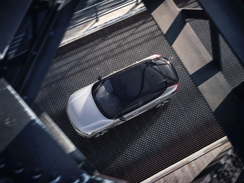
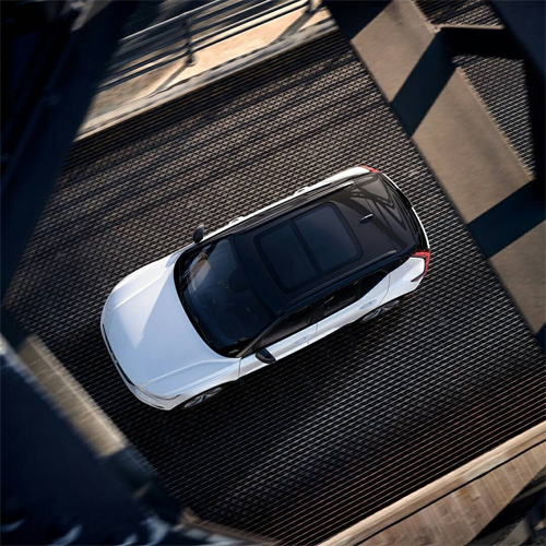
2021 – Volvo C40 Recharge on Lefty O’Doul Bridge at 3rd street in San Francisco, California, USA 🇺🇸.

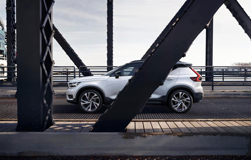
2017 – Volvo XC40 on Lefty O’Doul Bridge at 3rd street in San Francisco, California, USA 🇺🇸.

2017 – Volvo XC40 on Lefty O’Doul Bridge at 3rd street in San Francisco 🇺🇸.

2017 – Volvo XC40 on Lefty O’Doul Bridge at 3rd street in San Francisco, California, USA 🇺🇸.

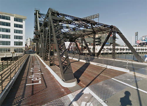
2018 – Lefty O’Doul Bridge at 3rd street in San Francisco (Google Streetview)

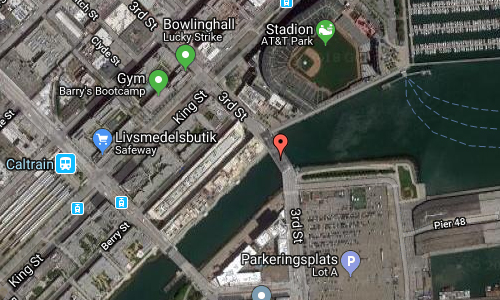
2018 – Lefty O’Doul Bridge at 3rd street in San Francisco (Google Streetview)

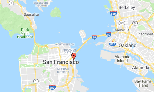
Lefty O’Doul Bridge is a bridge on the 3rd street in San Francisco, USA.

The Lefty O’Doul Bridge (also known as the Third Street Bridge or China Basin Bridge) is a drawbridge connecting the China Basin and Mission Bay neighborhoods of San Francisco, carrying Third Street across the Mission Creek Channel. It is located directly adjacent to AT&T Park.

It opened in 1933 and was renamed in 1969 in honor of the famous baseball player Lefty O’Doul.

The bridge carries five lanes of traffic. During normal conditions, the two easternmost lanes carry northbound traffic, the two westernmost lanes carry southbound traffic, and the center lane is reversible. Before, during, and after events at neighboring AT&T Park, the two easternmost lanes are closed to vehicles and used exclusively by pedestrians, while the remaining two easternmost lanes are reversible.

The bridge was seen in a chase sequence in the 1985 James Bond film A View to a Kill.
The bridge was also a key story point in the 1973 Clint Eastwood movies Magnum Force (during the climax involving a car chase), and in The Enforcer in 1976.
The bridge was also seen in the 2015 movie San Andreas starring Dwayne Johnson and Alexandra Daddario.

More information at en.wikipedia.org and www.foundsf.org.

Volvo Photo Locations

Bellevue Strandbad on Strandvejen in Klampenborg – DK 🇩🇰

December 6th, 2018

International Volvo Photo Locations Part 332
HOME - Volvo Photo Locations
HOME www.volvophotolocations.com

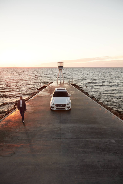
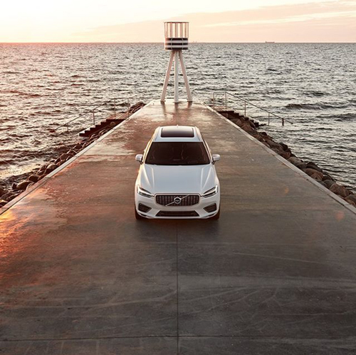
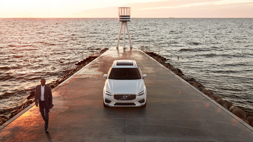
2017 – Volvo XC60 at Bellevue Strandbad on Strandvejen in Klampenborg, Denmark 🇩🇰

2017 – Volvo XC60 at Bellevue Strandbad on Strandvejen in Klampenborg, Denmark 🇩🇰

2017 – Volvo XC60 at Bellevue Strand in Denmark 🇩🇰

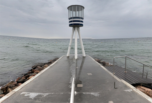
2018 – Bellevue Strandbad on Strandvejen in Klampenborg (Google Streetview)

2018 – Bellevue Strandbad on Strandvejen in Klampenborg (Google Streetview)

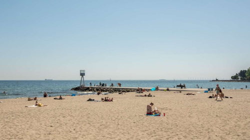
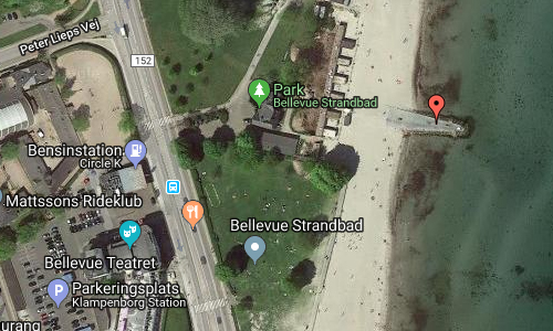
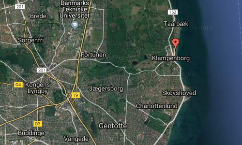
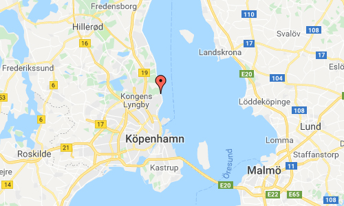
Bellevue Strandbad or Bellevue Beach is located on Strandvejen in Klampenborg, just 10 kilometers north of Copenhagen in Denmark.

The beach is very popular with locals during the summer months and can be reached in just five minutes’ walk from both Klampenborg S-train station and Dyrehaven.
The beach is 700 meters long and has both lifeguards and freshwater showers on the beach.
The beach is just off the picturesque fishing village, Tårbæk, and right next to Strandvejen at the Arne Jacobsen-designed Bellevue Theatre.

Klampenborg is a northern suburb to Copenhagen, Denmark. It is located in Gentofte Municipality, directly on Øresund, between Taarbæk and Skovshoved. Like other neighbourhoods along the Øresund coast, Klampenborg is an affluent area with many large houses.

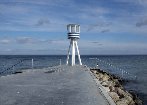
Arne Jacobsen-designed lifeguard tower Bellevue Beach

Klampenborg is known for a cluster of building projects by the Functionalist Danish architect Arne Jacobsen. These include Bellevue Beach, the Bellavista housing estate and the Bellevue Theatre, all completed between 1932–36 as some of the earliest Danish examples of Modernism. The area also includes a Jacobsen-designed restaurant, now called Jacobsen, which reopened in 2009 after thorough restoration and to good reviews.

Due to Bellevue Beach, Klampenborg is also a popular beach destination in summer, although the area draws fewer Copenhageners since the inauguration of Amager Beach Park and the Copenhagen Harbour Baths in 2005.

Klampenborg is also the main gateway to the extensive Deer Garden forest park, one of the most popular (semi-)natural areas in the Copenhagen area, known for its large deer population and ancient oak trees. The entrance, one of many, is located right next to Klampenborg Station and is marked by a red-painted wooden gate. In connection with the park lies the oldest operating amusement park in the world, Dyrehavsbakken, also located close to the station.

More information at en.wikipedia.org, www.arkitekturbilleder.dk and www.visitdenmark.com.

Volvo Photo Locations

Registro de la Propiedad de Barcelona Nº 03 on Carrer de Joan Miró in Barcelona – ES 🇪🇸

December 3rd, 2018

International Volvo Photo Locations Part 331
HOME - Volvo Photo Locations
HOME www.volvophotolocations.com

2017 – Volvo XC40 R-Design at Carrer de Joan Miró in Barcelona, Spain 🇪🇸.

2017 – Volvo XC40 R-Design at Carrer de Joan Miró in Barcelona, Spain 🇪🇸.

2018 – Volvo XC40 Inscription T5 AWDat Carrer de Joan Miró in Barcelona, Spain 🇪🇸.

2018 – Volvo XC40 Inscription T5 AWD at Carrer de Joan Miró in Barcelona Spain 🇪🇸.

2018 – Volvo XC40 Momentum at Carrer de Joan Miró in Barcelona Spain 🇪🇸.

2017 – Volvo XC40 R-Design at Registro de la Propiedad de Barcelona Nº 03 on Carrer de Joan Miró in Barcelona, Spain 🇪🇸.

2020 – Volvo XC40 Recharge P8 at Registro de la Propiedad de Barcelona Nº 03 on Carrer de Joan Miró in Barcelona, Spain 🇪🇸.

2021 – Volvo XC40 Recharge P8 at Registro de la Propiedad de Barcelona Nº 03 on Carrer de Joan Miró in Barcelona, Spain 🇪🇸.

2021 – Volvo XC40 Recharge P8 at Registro de la Propiedad de Barcelona Nº 03 on Carrer de Joan Miró in Barcelona, Spain 🇪🇸.

2018 – Carrer de Joan Miró in Barcelona (Google Streetview)

2018 – Carrer de Joan Miró in Barcelona (Google Streetview)

2018 – Carrer de Joan Miró in Barcelona (Google Streetview)

2018 – Carrer de Joan Miró and Av. d’Icària in Barcelona (Google Streetview)

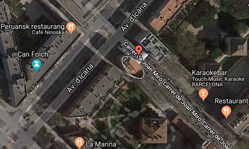
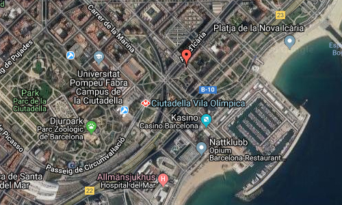
Carrer de Joan Miró is a street in Barcelona, Spain. This street runs from Carrer de Ramon Turró to Carrer de Salvador Espriu.

The street is named after Joan Miró. Joan Miró i Ferrà was a Spanish painter, sculptor, and ceramicist born in Barcelona. A museum dedicated to his work, the Fundació Joan Miró, was established in his native city of Barcelona in 1975, and another, the Fundació Pilar i Joan Miró, was established in his adoptive city of Palma de Mallorca in 1981.

Earning international acclaim, his work has been interpreted as Surrealism, a sandbox for the subconscious mind, a re-creation of the childlike, and a manifestation of Catalan pride. In numerous interviews dating from the 1930s onwards, Miró expressed contempt for conventional painting methods as a way of supporting bourgeois society, and declared an “assassination of painting” in favour of upsetting the visual elements of established painting.

Joan Miró

Joan Miró was among the first artists to develop automatic drawing as a way to undo previous established techniques in painting, and thus, with André Masson, represented the beginning of Surrealism as an art movement. However, Miró chose not to become an official member of the Surrealists in order to be free to experiment with other artistic styles without compromising his position within the group. He pursued his own interests in the art world, ranging from automatic drawing and surrealism, to expressionism, Lyrical Abstraction, and Color Field painting. Four-dimensional painting was a theoretical type of painting Miró proposed in which painting would transcend its two-dimensionality and even the three-dimensionality of sculpture.

More information at en.wikipedia.org and www.fmirobcn.org.

Volvo Photo Locations

Rue Pierre-Semard in Paris – F 🇫🇷

December 2nd, 2018

International Volvo Photo Locations Part 330
HOME - Volvo Photo Locations
HOME www.volvophotolocations.com

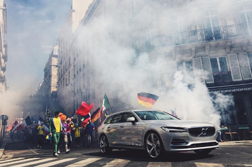
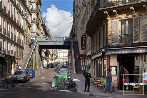
2016 - Volvo V90 at Rue Pierre-Semard in Rochechouart in Paris, France. Part of Volvo Cars’ new V90 campaign features footballing legend Zlatan Ibrahimović.

2016 – Volvo V90 at Rue Pierre-Semard in Rochechouart in Paris, France. Part of Volvo Cars’ new V90 campaign features footballing legend Zlatan Ibrahimović.

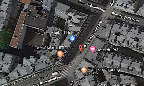
2016 – Volvo V90 at Rue Pierre-Semard and Rue Rochambeau in Paris, France. Part of Volvo Cars’ new V90 campaign features football legend Zlatan Ibrahimović.

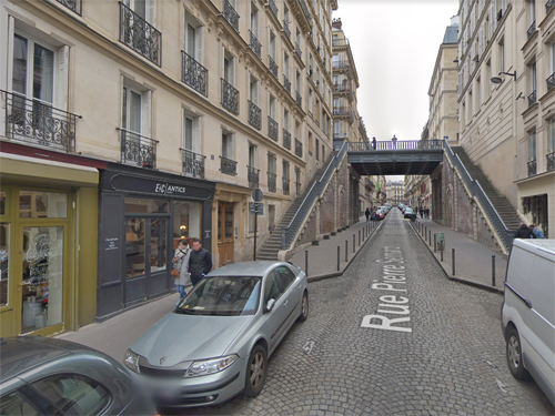
2018 – Rue Pierre-Semard and Rue de Bellefond in Paris (Google Streetview)

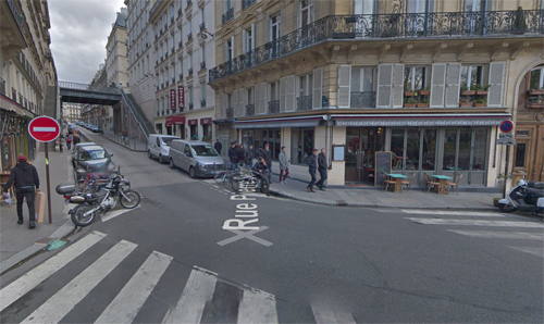
2018 – Rue Pierre-Semard and Rue Rochambeau in Paris (Google Streetview)

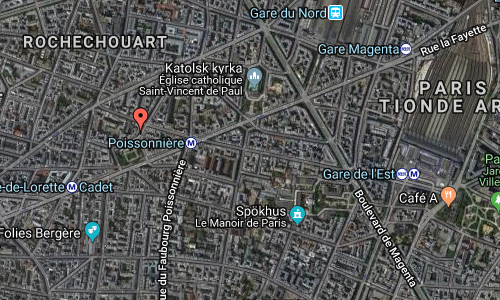
Rue Pierre-Semard is a street in 9e arrondissement in Paris, France. This street has a bridge crossing it with Rue de Bellefond.
Rue Pierre-Semard leads to Rue Rochambeau with the Square Montholon.

The street pays tribute to Pierre Semard (1887-1942), trade unionist, general secretary of the Federation of Railway Workers and leader of the PCF (Parti Communiste Français or the French Communist Party).

2018 – Rue Pierre-Semard in Paris (Photograpy by Thomas Schlijper)

Construction of the Square Montholon began in 1862, costing 160,000 francs, at the time of building of Rue Lafayette, and opened in 1863.
The square comprises two terraces and is encircled by a Louis-Philippe-style fence. The central grass garden is home to two hundred-year-old 30 m tall oriental plane trees as well a marble statuary group by Julien Lorieux dedicated to the young working women of the quarter.
A fountain with a bronze sculpture, “The Bear, the Eagle and the Vulture”, was removed and melted down in 1941 or 1942, during the Nazi occupation of Paris.

The 9th arrondissement of Paris (IXe arrondissement) is one of the 20 arrondissements of the capital city of France.

The arrondissement, called Opéra, is located on the right bank of the River Seine. It contains many places of cultural, historical, and architectural interest, including the Palais Garnier, home to the Paris Opera, Boulevard Haussmann, and its large department stores Galeries Lafayette and Printemps. The arrondissement has many theaters including Folies Bergères, Théatre Mogador and Théatre de Paris. Along with the 2nd and 8th arrondissements, it hosts one of the business centers of Paris, located around the Opéra.

More information at fr.wikipedia.org, www.mozasaguirre.com and en.parisinfo.com.

Volvo Photo Locations

Caja Vital Kutxa HQ on La Biosfera Ibilbidea in Vitoria-Gasteiz – ES 🇪🇸

December 2nd, 2018

International Volvo Photo Locations Part 329
HOME - Volvo Photo Locations
HOME www.volvophotolocations.com

2012 – Volvo V40 R-Design at Caja Vital Kutxa Bank HQ 🇪🇸

2012 – Volvo V40 R-Design at Caja Vital Kutxa Bank HQ 🇪🇸

2012 - Volvo V40 R-Design2

2012 – Volvo V40 R-Design at Caja Vital Kutxa Bank HQ on La Biosfera Ibilbidea in Vitoria-Gasteiz, Álava in Spain 🇪🇸

2012 – Volvo V40 R-Design at Caja Vital Kutxa Bank HQ on La Biosfera Ibilbidea in Vitoria-Gasteiz, Álava in Spain 🇪🇸

2018 – Caja Vital KutxaBank HQ on La Biosfera Ibilbidea in Vitoria-Gasteiz, Spain

2018 – Caja Vital KutxaBank HQ on La Biosfera Ibilbidea in Vitoria-Gasteiz, Spain

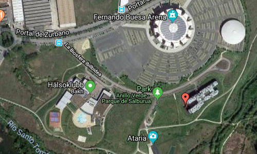
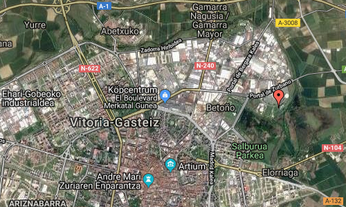
Caja Vital Kutxa Bank HQ is located on La Biosfera Ibilbidea in Vitoria-Gasteiz, Spain. This is the headquarters for the local savings bank. The building reproduces the scale of the surrounding small woods, a park of the Natura 2000 networking programme.

The floor plan has a chromosome shape with four arms. The structural concept is based on pairs of exterior metal supports, clad in stainless steel composite panels. One of the arms has been conceived as a 26 meter cantilever. In this case the concept changes and the pairs do not have any structural function.
A double height hall located in the heart of the building has its two façades enclosed by a work of art. They have been constructed with bright red polyurethane panels with a manually painted biological pattern.
The idea is to identify the building as a live organism in motion. A black skin made of glass protects the inhabited spaces behind the stainless steel pairs.

2018 – Caja Vital KutxaBank HQ on La Biosfera Ibilbidea in Vitoria-Gasteiz, Spain

Kutxabank is a bank based in the Basque Autonomous Community of Spain. It was officially founded on 1 January 2012 out of the merger of three Basque financial institutions operating on their respective provinces: Bilbao Bizkaia Kutxa (BBK), Gipuzkoa Donostia Kutxa (Kutxa), and Caja Vital Kutxa (Vital).

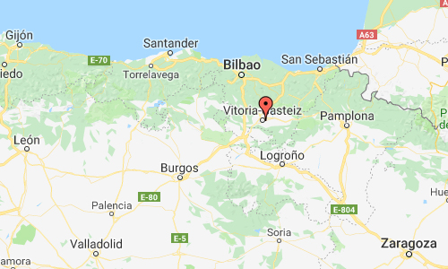
Vitoria-Gasteiz is the seat of government and the capital city of the Basque Autonomous Community and of the province of Araba/Álava in northern Spain. The dwellers of Vitoria-Gasteiz are called vitorianos or gasteiztarrak, while traditionally they are dubbed babazorros (Basque for ‘bean sacks’).

Vitoria-Gasteiz is a multicultural city with strengths in the arts, commerce, education, healthcare, architectural conservation, aeronautics, vehicle industry, oenology and gastronomy. It is the first Spanish municipality to be awarded the title of European Green Capital (in 2012) and it is consistently ranked as one of the 5 best places to live in Spain. The old town holds some of the best preserved medieval streets and plazas in the region and it is one of very few cities to hold two Cathedrals. The city also holds well known festivals such as the Azkena rock festival, FesTVal, Vitoria-Gasteiz jazz festival, and the Virgen Blanca Festivities.

Vitoria-Gasteiz’s vicinity is home to world-renowned wineries such as Ysios (by Santiago Calatrava) and the Marqués de Riscal Hotel (by Frank Gehry); relevant heritage sites including the Neolithic remains of Aizkomendi, Sorginetxe and La chabola de la Hechicera; Iron Age remains such as the settlements of Lastra and Buradón; antique remains such as the settlement of La Hoya and the salt valley of Añana; and countless medieval fortresses such as the Tower of Mendoza and the Tower of Varona.

More information at www.archdaily.com, www.mozasaguirre.com and en.wikipedia.org.

Thanks to Changyoung Jeong for finding this location!

Volvo Photo Locations

När Fyr on Närsholmen near När on Gotland 🇸🇪

December 2nd, 2018

Volvo Photo Locations Part 312
Historic Volvo Photography Locations Overview
bookmark www.volvophotolocations.com today!

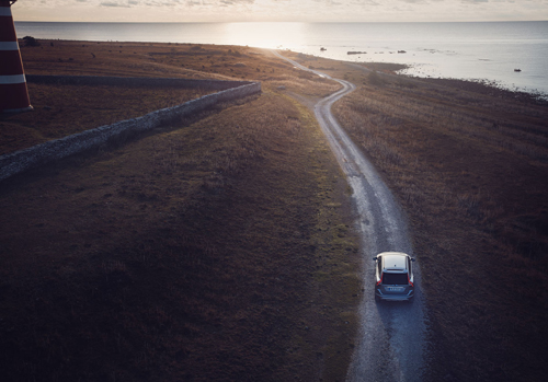
2014 – Volvo XC60 on Närsholmen near Stånga on Gotland 🇸🇪.

2014 – Volvo XC60 on Närsholmen near Stånga on Gotland 🇸🇪.

2016 - Volvo XC60 at Närsholmen near Stånga on Gotland

2016 – Volvo XC60 at Närsholmen near Stånga on Gotland 🇸🇪

2018 – När Fyr on Gotland

2018 – När Fyr on Gotland

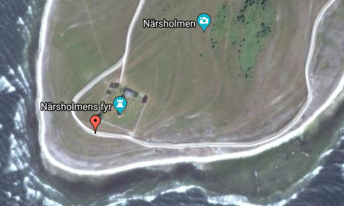
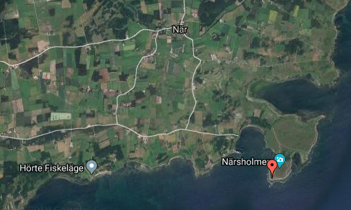
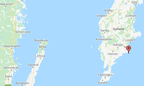
När Fyr is a lighthouse on the peninsula Närsholmen near När on Gotland, Sweden.

När Lighthouse is a Swedish lighthouse located outside the village När on the southeast side of the island Gotland. It was constructed in 1872, the sketchings were made by architect John Höjer. It is located in a nature reserve and birding area. It is a listed building in Sweden.

The light originally carried a kerosene lamp and it was updated with electric power in 1961. It was also automated that same year, and the rotating lens was replaced by a modern one. It is owned by the Swedish Maritime Administration.

När is a settlement on the Swedish island of Gotland, with 413 inhabitants in 2014. Formerly a socken, on 1 January 2016, it was reconstituted into the administrative area När District.

Gotland is Sweden’s largest island. The province includes the islands of Fårö and Gotska Sandön to the north, as well as the Karlsö Islands (Lilla and Stora) to the west. The island of Gotland and the other areas of the province of Gotland make up less than one percent of Sweden’s total land area.

The island’s main sources of income are agriculture along with food processing, tourism, information technology services, design, and some heavy industry such as concrete production from locally mined limestone. From a military viewpoint, it occupies a strategic location in the Baltic sea.

More information at fyr.org and sv.wikipedia.org.

Volvo Photo Locations

Göteborgs Gokartcenter on Bulyckevägen in Göteborg 🇸🇪

December 2nd, 2018

Volvo Photo Locations Part 311
Historic Volvo Photography Locations Overview
bookmark www.volvophotolocations.com today!

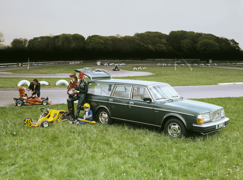
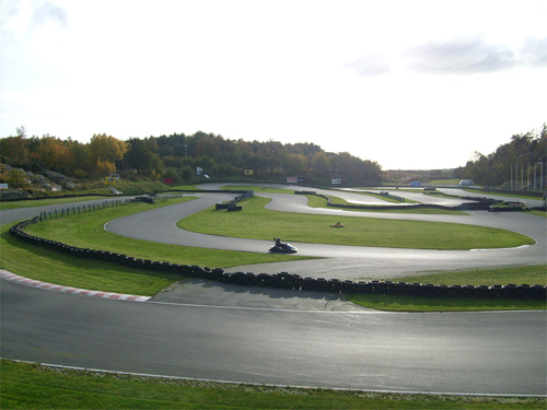
1980 - Volvo 265 GL at Göteborgs Gokart Center on Bulyckevägen in Torslanda in Göteborg, Sweden

1980 – Volvo 265 GL at Göteborgs Gokart Center on Bulyckevägen in Torslanda in Göteborg, Sweden

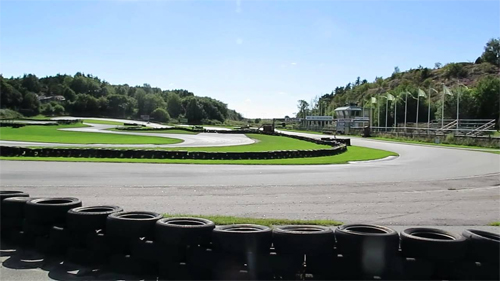
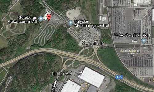
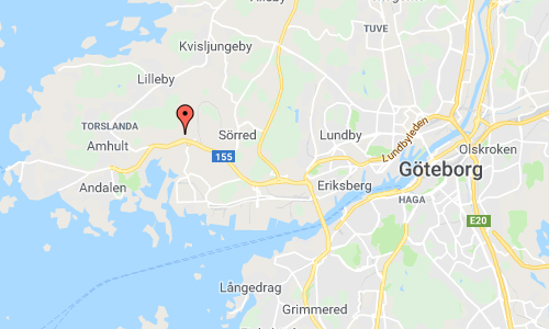
2018 – Göteborgs Gokartcenter on Bulyckevägen in Göteborg

2018 – Göteborgs Gokartcenter on Bulyckevägen in Göteborg

Göteborgs Gokartcenter is located on Bulyckevägen in Syrhåla on Hisingen in Göteborg. It is just west of the Volvo factory in Torslanda.

This gokart center is the only outdoor track in Göteborg.

The outdoor track is 1010 meters long and has lots of long, sweeping curves. The track is equipped with electronic timing and the spectators can follow the lap times and results on a TV-screen. The go carts they use outdoors are Caroli Hammerheads with a 270 cc engine. The top speed on the long straights reach close to 80 km/h. A good laptime on this track is around 58 seconds.

Their indoor track is available for both adults and children and they can drive together! The instructors divide the groups into slow and fast if needed so that your experience with us will be as good as possible.
The indoor track is 300 meters long. It is a technical and intense asphalt track with good rhythm. The cars they use indoors are Caroli Hammerheads with a 200 cc engine, well adapted to our particular track and the conditions that prevail here. On the big screen, you can follow lap times and position. ​On this track we can drive up to a maximum of 8 gocarts simultaneously.
Drop-in, if you just want to come and drive without booking, this takes place during our open drop-in times.
​​​​​​​Drop-in times vary depending on bookings and you can find the times for the next three days under Drop-In times here on the page.

Syrhåla is a district on western Hisingen in Göteborg. The district was formed by decision of the magistrate in Göteborg on March 3, 1957, when Arendal was divided into the Arendal and Syrhåla districts.
The name Syrhåla is dated from 1550 from Siöralla. The meaning is a marshy place, sour land (Sürhola) of the low and moist soil between the mountains, east and southeast of the older village.

More information at robusta.se and sv.wikipedia.org.

Volvo Photo Locations

Viktoriagatan in Göteborg 🇸🇪

December 2nd, 2018

Volvo Photo Locations Part 310
Historic Volvo Photography Locations Overview
bookmark www.volvophotolocations.com today!

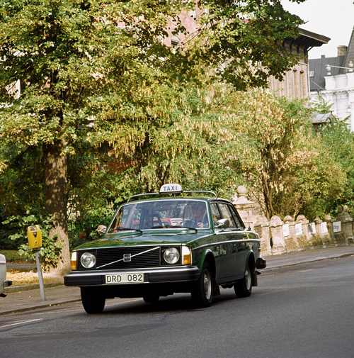
1976 – Volvo 244 Taxi on Viktoriagatan in Göteborg, in the back you can just see a small part of the famous Tomtehuset!

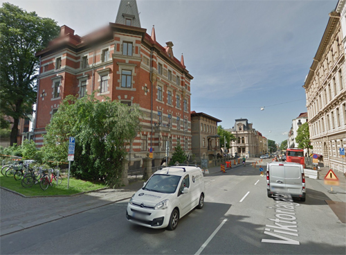
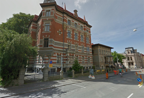
2018 – Viktoriagatan in Göteborg (Google Streetview)

2018 – Viktoriagatan in Göteborg (Google Streetview)

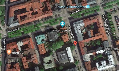
Viktoriagatan is a street in the districts of Vasastaden and Landala in Göteborg. It stretches from Nya Allén at Kungsparken and up to Föreningsgatan.

Viktoriagatan was named in 1882 as a tribute to the Crown Princess Viktoria, who came to Sweden via Göteborg for the first time in 1881. It was municipal politician Philip Leman who proposed the name. The street was previously a continuation on Magasinsgatan, called Upper Magasinsgatan (1867-82), between “pedestrian crossing of Vallgraven to Ulriceberg”.

On its way to Föreningsgatan, passes Viktoriagatan; Parkgatan – Storgatan – Bellmansgatan – Vasagatan – Engelbrektsgatan and Thorildsgatan.

In the photo with the Volvo 244 Taxi, you see a glimpse e the famous Tomtehuset.

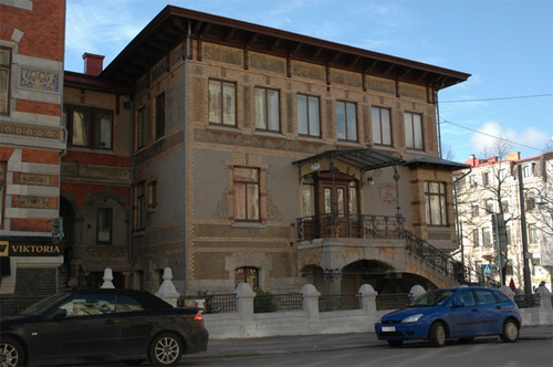
2018 – Tomtehuset

Tomtehuset is a villa-house in the Viktoriagatan / Vasagatan crossing. The house was built in 1890 for the publicist and riksdagsman Sven Adolf Hedlund after drawings by the architects Hans Hedlund – grandson to the builder – and Yngve Rasmussen. The house is a monument since October 25, 1982.

The house has two floors with a south-terraced floor and is built in brick with a facade with tiled surfaces combined with bricks. On the first floor there are all fresco paintings around the windows. On the second floor to Vasagatan there are murals that reflect the house’s first inhabitants and their occupations. On the paintings, plots appear as architect, book prints and photographer.
The paintings are signed with the architects and Thorvald Rasmussen initials and dated 4/10 1890. Thorvald Rasmussen was an artist with tomter as special and brother to Yngve Rasmussen. If Hedlund and the brothers Rasmussen performed the paintings themselves, it is not entirely clear. In any case, the goalkeeper Q.W. Bergqvist engaged in painting works.

The upper floor, originally furnished to photo studio, was rebuilt into 1920s housing, with a large glass window facing Vasagatan walled again and the roof changed. Otherwise, the exterior maintains its original condition.

More information at goteborgshistoria.com and sv.wikipedia.org.

Volvo Photo Locations

221 W 2nd St Parking in Los Angeles – USA 🇺🇸

November 18th, 2018

International Volvo Photo Locations Part 328
HOME - Volvo Photo Locations
HOME www.volvophotolocations.com

2016 – Volvo S60L Twin Engine T6 in 221 W 2nd Street Parking on South Broadway and W 2nd St in Los Angeles, California USA 🇺🇸.

2016 – Volvo S60L Twin Engine in 221 W 2nd Street Parking on South Broadway and W 2nd St in Los Angeles, California USA 🇺🇸.

2016 – Volvo S60 Inscription in 221 W 2nd Street Parking on South Broadway and W 2nd St in Los Angeles, California USA 🇺🇸.

2016 – Volvo S60 Inscription in 221 W 2nd Street Parking in Los Angeles 🇺🇸

2018 – 221 W 2nd St Parking in Los Angeles (Google Streetview)

2018 – 221 W 2nd St Parking in Los Angeles (Google Streetview)

221 W 2nd Street Parking is a roof top parking on South Broadway and W 2nd St in central Los Angeles, California.

Its location is close to the Los Angeles Times building, the Los Angeles Police Department Headquarters and Los Angeles Cityhall.

From this rooftop parking, you get an great view on the LA skyline. Buildings visible on these photos are Million Dollar Theater building and Gas Company Tower (or Deloitte Tower).

The Million Dollar Theatre at 307 S. Broadway in Downtown Los Angeles is one of the first movie palaces built in the United States. It opened in 1917 with the premiere of William S. Hart’s The Silent Man. It’s the northernmost of the collection of historical movie palaces in the Broadway Theater District and stands directly across from the landmark Bradbury Building. The theater is listed in the National Register of Historic Places.

The Million Dollar was the first movie house built by entrepreneur Sid Grauman. Grauman was later responsible for Grauman’s Egyptian Theatre and Grauman’s Chinese Theatre, both on Hollywood Boulevard, and was partly responsible for the entertainment district shifting from downtown Los Angeles to Hollywood in the mid-1920s.

Sculptor Joseph Mora did the elaborate and surprising exterior Spanish Colonial Revival ornament, including bursts of lavish Churrigueresque decoration, statues, longhorn skulls, and other odd features. The auditorium architect was William L. Woollett, and the designer of the 12-story tower was Los Angeles architect Albert C. Martin Sr.

For many years, the office building housed the headquarters of the Metropolitan Water District of Southern California.

Ira Yellin (then the owner of Grand Central Market) acquired the building in 1989. In 2017, the building was sold to Langdon Street Capital, and the theater and retail space were leased to fashion startup CoBird.

The exterior of the theater, along with the Bradbury Building across the street, appear prominently in several films shot on location, including D.O.A. (1950) and Blade Runner (1982). The theatre was featured in the videogame Grand Theft Auto V as the Ten Cent Theatre.

Gas Company Tower is a 52-story, 228.3 m class-A office skyscraper on Bunker Hill in downtown Los Angeles, California. Located on the north side of Fifth Street between Olive Street and Grand Avenue, across from the Biltmore Hotel, the building serves as the headquarters for the Southern California Gas Company, which vacated its previous offices on Eighth- and Flower-streets in 1991, and is home to the Los Angeles offices of Arent Fox and Sidley Austin.

In 2014, Deloitte became the first tenant to have their logo affixed to the peak of the building which had been left plain since the building was completed. This giant accounting firm moved from nearby Two California Plaza, where it had been since 2000.

More information at www.milliondollar.la, en.wikipedia.org/wiki/Million_Dollar_Theater and en.wikipedia.org/wiki/Gas_Company_Tower.

Volvo Photo Locations