home

[ Content | Sidebar ]

Kulla Gunnarstorp slott in Hittarp 🇸🇪

February 24th, 2018

Volvo Photo Locations Part 280
Historic Volvo Photography Locations Overview
bookmark www.volvophotolocations.com today!

1972 – Volvo 164E at Kulla Gunnarstorp slott in Hittarp, Sweden
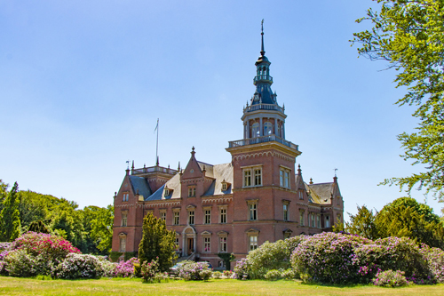
2019 – Kulla Gunnarstorp Slottet

1976 – Volvo 265 GL at Kulla Gunnarstorp slott in Hittarp, Sweden

2018 – The new Kulla Gunnarstorp slott in Hittarp

1979 – Volvo 265 GLE at Kulla Gunnarstorp slott in Hittarp (near Helsingborg), Sweden

1979 – Volvo 265 GLE at Kulla Gunnarstorp slott in Hittarp (near Helsingborg), Sweden

1977 – Volvo 245 DL at Kulla Gunnarstorp slott in Hittarp (near Helsingborg), Sweden

2018 – the old Kulla Gunnarstorp slott in Hittarp

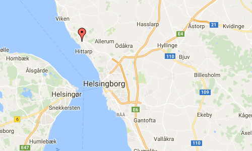
Kulla Gunnarstorp Castle (Swedish: Kulla Gunnarstorps slott) is a castle in Hittarp, which is part of Helsingborg Municipality, Skåne, in southern Sweden. The property actually contains two castles on its grounds; the old castle was built in the 16th century by Jørgen Ottesen Brahe. In the 19th century a new one was built by Baltzar von Platen (1804-1875).

The old castle, originally called Gundestrup around 1500, once belonged to the family Parsberg. It passed in the mid-1500s to the Privy cuncil member Jörgen Brahe through marriage. He built the old castle, which still exists on the estate. The castle was bought in 1639 by Axel Eriksen Rosenkrantz of Glimmingehus and in 1775 it was sold to Count Gustaf Adolf Sparre, who built up a fine collection of paintings there.

After his widow’s death it passed to their grandson Gustav Adolf Frederick De la Gardie, and after his death, to his son Jacob de la Gardie. He sold the estate with its collection in 1837 to Carl De Geer of Leufsta.

After Count De Geer’s death in 1861 his son Baltzar von Platen (1804-1875) inherited it, who built the new castle, designed by Danish architect Christian Zwingmann. Then the estate passed to his daughter Elisabeth von Platen, who married Axel Wachtmeister and later lived at Wanås Castle.

The property remained in the Wachtmeister family name until 1978, when the current owner Gustav Trolle inherited the estate from his mother, Charlotte (née Wachtmeister). Kulla Gunnarstorp has traditionally favored and supported Allerums church , where the castle is located in Allerums congregation but also the Bay church formerly belonged Väsby church has at times been under the castle lord’s patronage.

More information at sv.wikipedia.org and gardsbutikenkulla.se.

Volvo Photo Locations

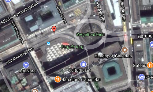
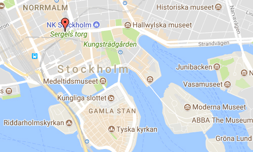
Klarabergsgatan at Sergels torg in Stockholm 🇸🇪

February 24th, 2018

Volvo Photo Locations Part 279
Historic Volvo Photography Locations Overview
bookmark www.volvophotolocations.com today!

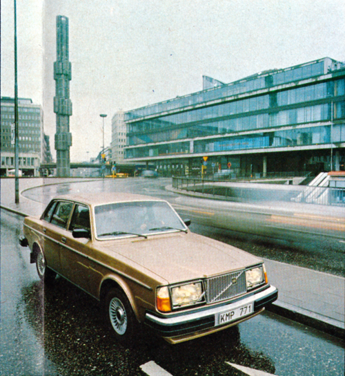
1980 – Volvo 264 GLE at Sergels torg in Stockholm

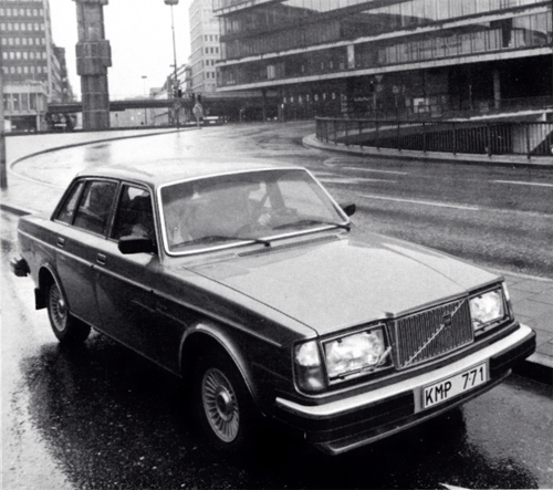
1980 – Volvo 264 GLE at Sergels torg in Stockholm

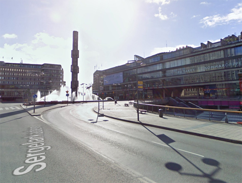
2009 – Klarabergsgatan at Sergels torg in Stockholm (Google Streetview)

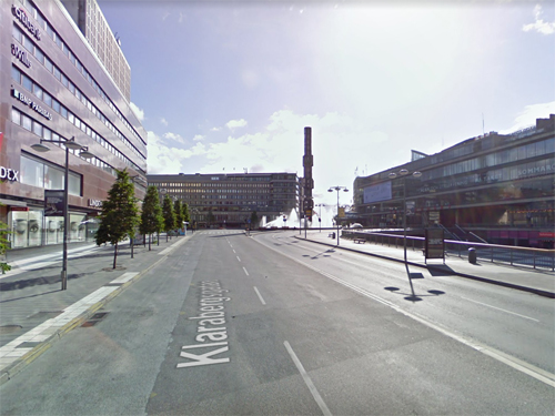
2009 – Klarabergsgatan at Sergels torg in Stockholm (Google Streetview)

Klarabergsgatan is a street in central Stockholm that runs from Klarabergsviadukten in the west to Sergels torg in the east.

Sergels torg (“Sergel’s Square”) is the most central public square in Stockholm, Sweden, named after 18th-century sculptor Johan Tobias Sergel, whose workshop was once located north of the square.

Sergels torg has a dominant west-to-east axis and is divided into three distinct parts:

1. A sunken pedestrian plaza furnished with a triangular-colored floor pattern (colloquially referred to as Plattan, “The Slab”) and a wide flight of stairs leading up to the pedestrian street Drottninggatan, connecting south to Stockholm Old Town and north to Kungsgatan.

2. This plaza is partly overbuilt by a roundabout centered on a glass obelisk and by the concrete decks of three major streets.

3. North of this traffic junction is a considerably smaller open space overlooked by the high-rise fasade of the fifth Hötorget Building from where the avenue Sveavägen extends north.

The site south of the square is taken up by the cultural center Kulturhuset, which also houses the Stockholm City Theater and hides the Riksbanken (Bank of Sweden) headquarters facing the square Brunkebergstorg behind. Klarabergsgatan leads west past the department store Åhléns City and Klara Church to Klarabergsviadukten and Kungsholmen. Hamngatan leads east under Malmskillnadsgatan to Kungsträdgården, Norrmalmstorg, and Strandvägen. Together with the underground mall east of the pedestrian plaza and the T-Centralen metro station and other continuous underpasses west thereof, Sergels torg forms part of a continuous underground structure almost a kilometer in length.

Since its creation, Sergels torg has been much criticized for giving priority to cars at the cost of pedestrians. It has, among some quarters, become the main target for criticism of the much debated demolition of the central city district of Klara during the 1950s and 1960s. Nevertheless, it is not dissimilar to but larger than the public space in front of Centre Georges Pompidou in Paris and much like its French counterpart remains the most popular space in Stockholm for meeting friends, for political demonstrations, for a wide range of events, and for drug-dealers. This includes the fountain, in which people celebrate every major victory by a Swedish sports team.

More information at en.wikipedia.org and stockholmskallan.stockholm.se.
Volvo Photo Locations

Brösarps backar on Albovägen in Brösarp 🇸🇪

February 24th, 2018

Volvo Photo Locations Part 278
Historic Volvo Photography Locations Overview
bookmark www.volvophotolocations.com today!

2015 – Volvo V60 R-Design at Brösarps Backar on Albovägen in Brösarp, Skåne, Sweden 🇸🇪.

2014 – Volvo V70 at Brösarps Backar on Albovägen in Brösarp, Skåne, Sweden 🇸🇪.

2014 – Volvo V70 at Brösarps Backar on Albovägen in Brösarp, Skåne, Sweden 🇸🇪.

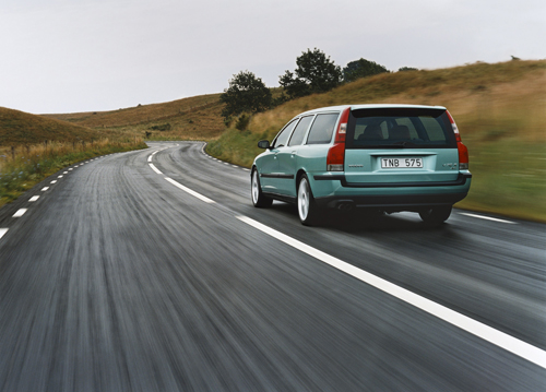
2002 - Volvo V70 R somewhere in Skåne

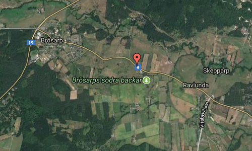
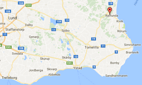
2003 – Volvo V70 R on Albovägen (9) just outside Brösarp to Ravlunda in Österlen, also known as one of the most beautiful roads in Sweden 🇸🇪.

2003 – Volvo S60 R, also on the same road near Brösarp in Österlen, Sweden 🇸🇪.

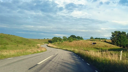
2018 – Albovägen in Brösarp (Google Streetview)

2018 – Albovägen in Brösarp (Google Streetview)

Riksväg 9 is a road crossing Brösarps backar between Brösarp and Ravlunda in eastern Skåne. This road is also know as one of the most beautiful roads in Sweden!

According to a survey conducted by the company YouGov together with the car company Kia, it was found that the Swedes favorite road is road 9 between Brösarp and Ystad. A total of 15 percent of the approximately 1,000 interviewees stated that they preferred to travel this route during their vacation and considered that highway 9 was Sweden’s most beautiful route.

This road also has one of Skåne’s best resting places. In 2007, the resting place was crossed at road 9 in Brösarp’s southern slopes to Skåne’s best resting place of Motormännen. As a cream on the mash, the Swedish Transport Administration has recreated the old apple sunday at the resting place, so that guests can calamize different apples during their breaks in the southern slopes of Brösarp.

Brösarp is a locality situated in Tomelilla Municipality, Skåne County, Sweden near the Hallamölla waterfall, with 680 inhabitants in 2010.

More information at brosarp.se/sveriges-vackraste-vag/ and brosarp.se/brosarps-backar/.

Volvo Photo Locations

Södra Strandgatan in Gävle 🇸🇪

February 24th, 2018

Volvo Photo Locations Part 277
Historic Volvo Photography Locations Overview
bookmark www.volvophotolocations.com today!

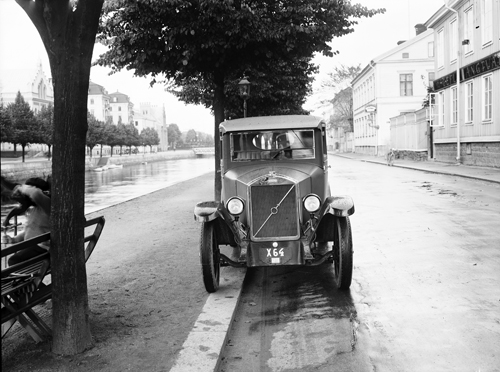
1928 – Volvo PV4 on Södra Strandgatan in Gävle, Sweden

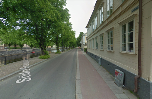
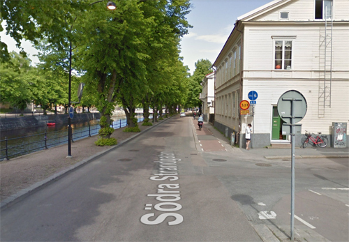
2018 – Södra Strandgatan in Gävle, Sweden (Google Streetview)

2018 – Södra Strandgatan in Gävle, Sweden (Google Streetview)

Södra Strandgatan is a street in the center of Gävle.

Gävle is a city in Sweden, the seat of Gävle Municipality and the capital of Gävleborg County. It had almost 100.000 inhabitants in September 2016, which makes it the 13th most populated city in Sweden. It is the oldest city in the historical Norrland (Sweden’s Northern Lands), having received its charter in 1446 from Christopher of Bavaria. However, Gävle is far nearer the greater Stockholm region than it is to the other major settlements in Norrland.

In recent years, the city has received a lot of international attention due to its large Yule Goat figure made of straw – the Gävle Goat. The goat is erected in December each year and is often subsequently vandalised, usually by someone setting it on fire. The goat has now become a symbol for the city and is being used for various marketing purposes.

Gävle is situated by the Baltic Sea near the mouth of the river Dalälven. At 60 degrees north and 17 degrees east, Gävle has the same latitude as Helsinki and the same longitude as Vienna and Cape Town.

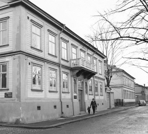
1960 – Södra Strandgatan in Gävle

Gävle is known for being the birthplace of the Gevalia coffee brand, which is produced by Kraft General Foods Scandinavia and exported around the globe. Gevalia is particularly popular in the Americas and produces dozens of unique flavored coffees for the United States that are not available to its customers in Europe. However, visitors who come to the factory in Gävle can sample many of the premium blends. (Gevalia is the Latin name for Gävle).

Other brands from Gävle include the throat lozenges Läkerol and the car-shaped sweets Ahlgrens Bilar. Unfortunately, Cloetta has closed down the factory in Gävle.

More information at en.wikipedia.org and www.visitgavle.se.

Volvo Photo Locations

Sansome St in San Francisco – USA 🇺🇸

November 26th, 2017

International Volvo Photo Locations Part 310
HOME - Volvo Photo Locations
HOME www.volvophotolocations.com

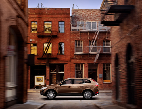
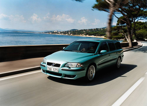
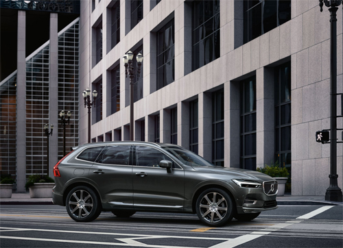
2009 – Volvo XC60 at 704 Sansome St in San Francisco, CA in USA.

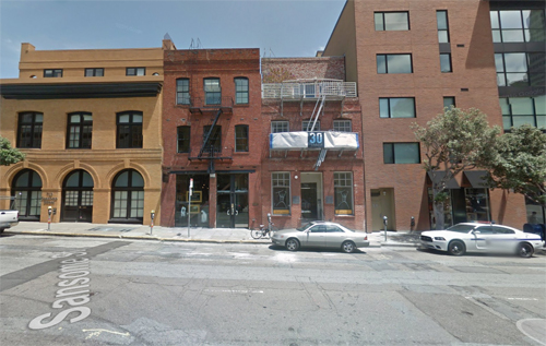
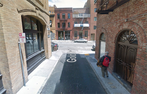
2017 – 704 Sansome St in San Francisco USA (Google Streetview)

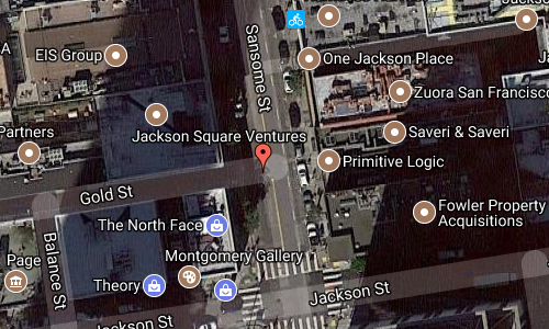
2017 – 704 Sansome St and Gold St in San Francisco USA (Google Streetview)

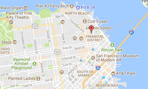
Sansome street is a street in the financial center of San Francisco in California, USA.

At the begining of Sansome Street, there is the famous One Sansome Street building, also known as Citigroup Center. It is an office skyscraper located at the intersection of Sutter and Sansome Streets in the Financial District of San Francisco, California near Market Street. The 168 m, 41 floor, 54,578.0 m2 office tower was completed in 1984.

The One Sansome Street tower is built adjacent to the site of the ornate Anglo and London Paris National Bank, which was completed in 1910. Designed by architect Albert Pissis, the bank building was granite clad with 12 m high Doric columns. The historic architecture of the bank building serves as a conservatory for the skyscraper today.

Keker & Van Nest LLP is a premier litigation boutique located in San Francisco, California. For more than thirty years, Keker & Van Nest has tried and litigated complex, high-stakes civil and criminal cases throughout the nation. Areas of practice include intellectual property, professional liability, class actions, general contract and commercial litigation, antitrust, white collar crime, and appellate.
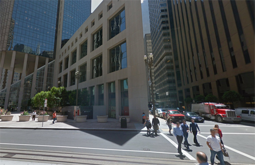
The Financial District is a neighborhood in San Francisco, California, that serves as its main central business district. It is home to the city’s largest concentration of corporate headquarters, law firms, insurance companies, real estate firms, banks, savings and loans, and other financial institutions.

The area is marked by the cluster of high-rise towers in the triangular area east of Grant Avenue, south of Washington Street, west of the Embarcadero that rings the waterfront, and north of Market Street. The city’s tallest buildings, including 555 California Street and the Transamerica Pyramid, and many other tall buildings, such as 101 California Street and 345 California Street are located there. Montgomery Street (“Wall Street of the West”) is the traditional heart of the district.

More information at www.sftravel.com/ and www.primitivelogic.com.

Thanks to Changyoung Jeong for finding this location!

Volvo Photography Locations

D559 near Sainte-Maxime – F 🇫🇷

November 26th, 2017

International Volvo Photo Locations Part 309
Volvo Photo Atlas - Volvo Photo Locations Overview
bookmark www.volvophotolocations.com today!

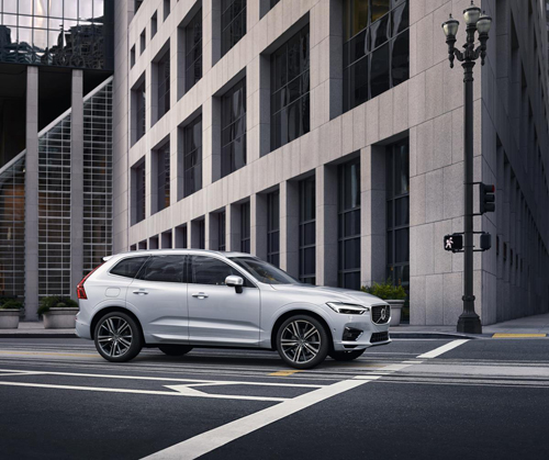
2003 – Volvo V70 R at D559 in 83120 Sainte-Maxime, France 🇫🇷.

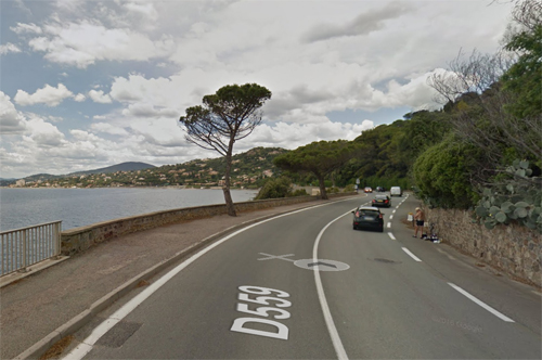
2017 – D559 near Sainte-Maxime in France (Google Streetview)

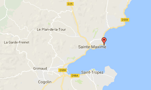
Road D559 is a coastal road east Sainte-Maxime in the South of France.

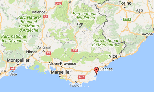
Sainte-Maxime is a commune and city in the Var department in the Provence-Alpes-Côte d’Azur region. I.e. on the French Riviera (Côte d’Azur) in southeastern France 90 km west from Nice and 130 km east from Marseille.

The small town is south facing at the northern shore of the Gulf of Saint-Tropez. In the north the Massif des Maures mountain range protects it from cold winds of the Mistral. Sainte Maxime was founded around 1000 AD by the Monks from the Lérins Islands outside Cannes. They built a monastery and named the village after one of the Saints of their order – Maxime. Fishing was the mainstay for the inhabitants but during the early 19th century increasing amounts of lumber, cork, olive oil and wine was shipped to Marseilles and to Italy.

The village grew and in the 20th century it started to attract artists, poets and writers who enjoyed the climate, the beautiful surroundings and the azure blue water. In front of the old town you find the characteristic tower – La Tour Carrée – built by the monks in the early 16th century to protect the village from invaders. With an addition of a battery of cannons and with the Tour du Portalet in Saint Tropez the whole bay was protected. As late as in the beginning of the 19th century, Napoleon ordered a restoration of the battery while also adding cannons on the Lérins Islands. The tower is now a museum.

More information at en.wikipedia.org and www.sainte-maxime.com.

Thanks to Changyoung Jeong for finding this location!

Volvo Photography Locations

California St & Front St in San Francisco – USA 🇺🇸

November 26th, 2017

International Volvo Photo Locations Part 308
Click for Volvo Photography Locations Overview

2017 – Volvo XC60 on 181 California St and Front St in San Francisco

2017 – Volvo XC60 on 181 California St and Front St in San Francisco, CA, USA.

2017 – Volvo XC60 on 181 California St and Front St in San Francisco, CA, USA.

2017 – California St and Front St in San Francisco USA (Google Streetview)

2017 – California St and Front St in San Francisco USA (Google Streetview)

California Street is a major thoroughfare in San Francisco, California. Fifty-four blocks of California Street, from Van Ness Avenue westward to 32nd Avenue, comprised the last major leg of the final 1928 alignment of the Lincoln Highway, the first road across America, leading out to the highway’s western terminus in Lincoln Park.

California Street is one of the longest streets in San Francisco, and includes a number of important landmarks. It runs in an approximately straight 8.4 km east-west line from the Financial District to Lincoln Park in the far Northwest corner of the City. It begins at the intersection of Market Street and Spear Street in front of the Hyatt Regency Embarcadero Center, one block from the Ferry Building, then travels over Nob Hill, through Lower Pacific Heights, Laurel Heights, and the Lake District. The street makes a slight bend in at the intersection of Cornwall Street and 7th Avenue, then parallels the edge of the Presidio of San Francisco through the Richmond District until its dead-end terminus at 32nd Avenue, at Lincoln Park. The route has four to six lanes for its entire length, and a cable car line on the Eastern portion from Market to Van Ness Avenue.

More information at en.wikipedia.org.

Thanks to Changyoung Jeong for finding this location!

Volvo Photography Locations

Katz on Frederiksholms Kanal in Copenhagen – DK 🇩🇰

November 26th, 2017

International Volvo Photo Locations Part 307
Click for Volvo Photography Locations Overview

2017 – Volvo S90 at Frederiksholms Kanal in København or Copenhagen Denmark 🇩🇰

2017 – Volvo V90 at Katz on Frederiksholms Kanal in Copenhagen, Denmark 🇩🇰

2017 – Katz at Frederiksholms Kanal in Copenhagen, Denmark (Google Streetview)

2017 – Katz at Frederiksholms Kanal in Copenhagen, Denmark (Google Streetview)

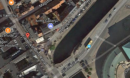
Katz at Frederiksholms Kanal in København is a restaurant and bar that serves classic favorites and Mediterranean cuisine from the traditional Danish cuisine.

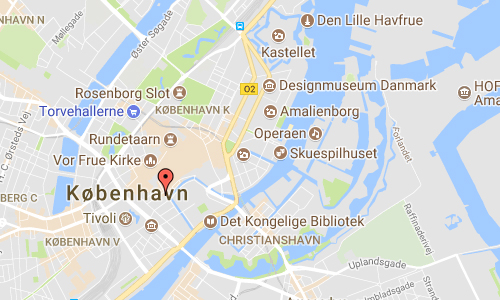
Frederiksholms Kanal is a canal in central Copenhagen, Denmark, which runs along the south-west side of Slotsholmen, together with Slotholmens Kanal separating the island from Zealand. The name also applies to the continuation of Rådhusstræde which follows the canal for most of its course, first on its south side and for the last stretch, from Prinsens Bro and to the waterfront, on both sides of the canal. Several historic buildings face the canal, ranging in size from Prince’s Mansion, now housing National Museum, and Christiansborg’s riding grounds to the diminutive Stable Boy’s House, part of Civiletatens Materialgård, a former storage facility now used by the Royal Danish Academy of Fine Arts’s School of Sculpture.

More information at en.wikipedia.org and katz.dk.

Volvo Photography Locations

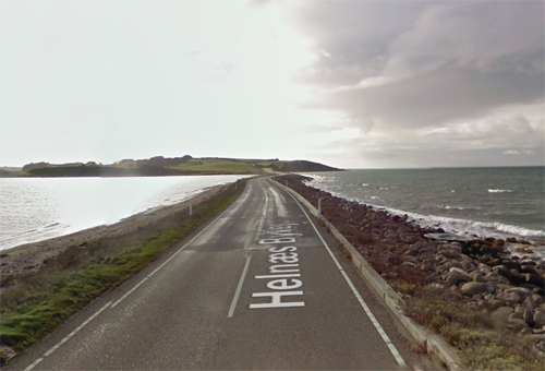
Langøre-dæmningen Helnæs Byvej in Ebberup – DK 🇩🇰

November 26th, 2017

International Volvo Photo Locations Part 306
Volvo Photo Atlas - Volvo Photo Locations Overview
bookmark www.volvophotolocations.com today!

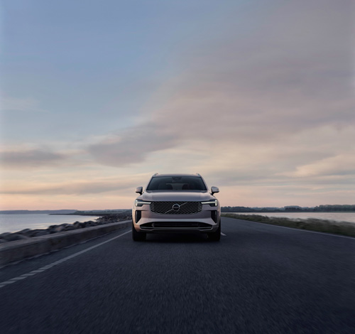
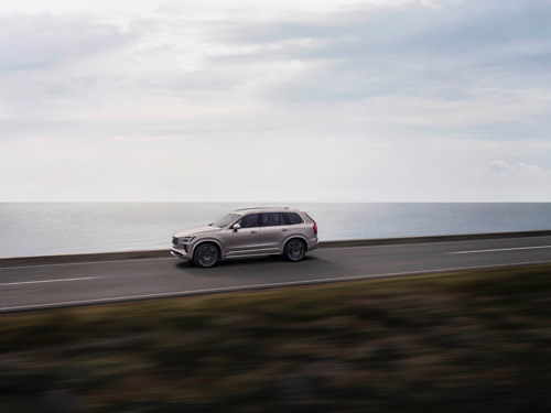
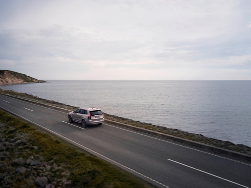
2024 – Volvo XC90 on “Langøre-dæmningen” connecting the peninsula Helnæs with the island Fyn in Denmark. 🇩🇰

2024 – Volvo XC90 on “Langøre-dæmningen” connecting the peninsula Helnæs with the island Fyn in Denmark. 🇩🇰

2024 – Volvo XC90 on “Langøre-dæmningen” connecting the peninsula Helnæs with the island Fyn in Denmark. 🇩🇰

2024 – Volvo XC90 on “Langøre-dæmningen” connecting the peninsula Helnæs with the island Fyn in Denmark. 🇩🇰

2024 – Volvo XC90 on “Langøre-dæmningen” connecting the peninsula Helnæs with the island Fyn in Denmark. 🇩🇰

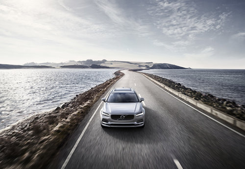
2016 – Volvo V90 on “Langøre-dæmningen” connecting the peninsula Helnæs with the island Fyn in Denmark. 🇩🇰

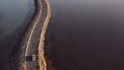
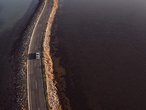
2017 – Volvo XC60 on “Langøre-dæmningen” connecting the peninsula Helnæs with the island Fyn in Denmark. 🇩🇰

2017 – Volvo XC60 on “Langøre-dæmningen” connecting the peninsula Helnæs with the island Fyn in Denmark. 🇩🇰

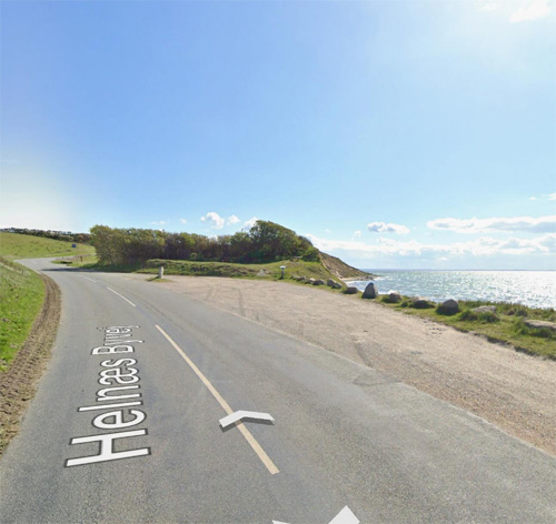
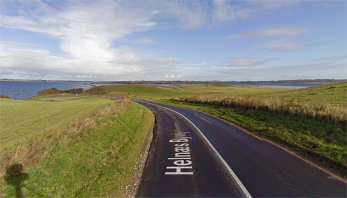
2024 – Volvo XC90 on Helnæs Byvej on Helnæs Nord on Helnæs in Denmark 🇩🇰.

2024 – Volvo XC90 on Helnæs Byvej on Helnæs Nord on Helnæs in Denmark 🇩🇰.

2024 – Volvo XC90 on Helnæs Byvej on Helnæs Nord on Helnæs in Denmark 🇩🇰.

2024 – Volvo XC90 on Helnæs Byvej on Helnæs Nord on Helnæs in Denmark 🇩🇰.

2017 – Volvo XC60 at Helnæs Byvej on Helnæs in Ebberup Denmark 🇩🇰

2017 – Helnæs Byvej in Ebberup, Denmark (Google Streetview)

2024 – Helnæs Byvej on Helnæs Nord in Denmark (Google Streetview).

2017 – Helnæs Byvej in Ebberup, Denmark (Google Streetview)

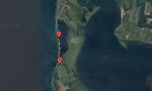
Langøre-dæmningen or Helnæs Byvej as the road is named, connects the peninsula Helnæs with the island Fyn in Ebberup, Denmark.

Helnæs is an island on the southwestern coast of Funen, Denmark, southwest of Haarby and northwest of Faaborg. It belongs administratively to Assens Municipality and is connected to the town of Assens by road to the north.

Between Helnæs and the main island of Funen is Helnæs Bay, which contains the sprawling islands of Illumø, Horsehoved and Vigø to the southeast. The principal settlement of Helnæs lies on the southeast coast, and contains the camping site Helnæs Camping to the north of it, although the historical village of Helnæs By is further to the north, inland. The highest point of the island is Galgebakke, at 8.8 m.

There is a runestone on the island, known as the Helnæs Runestone. The 28 metres high Helnæs Lighthouse was completed in 1901.

Helnæs is a fascinating peninsula to visit, with its magnificent scenery, active cultural and artistic life, and interesting past, offering a wealth of things to explore and see.

Helnæs has been inhabited since the Stone Age. Five burial mounds dominate the landscape in the hills south of Maden. Helnæs is first mentioned in historical records in 1231 as “Hælghænæs” (sacred promontory). Take the narrow road out to Helnæs and encounter this impressive landscape. Just after the road to Helnæs, the hills, Bobakkerne, rise up like a giant embankment, which is blanketed with colourful flowers in summer. This pastureland is open to walkers as the Danish Nature Agency has purchased the area.

Further south on Helnæs, is the huge meadowland, Maden, west of the town of Helnæs. Almost 300 hectares of meadows and fields lie behind the beach ridges along the Little Belt. The Danish Nature Agency has purchased some of the areas and, together with Funen County, is in the process of improving the nature and access to the areas.

Just after the road out to Helnæs, the hills, Bobakkerne, rise up like a giant embankment, which is blanketed with colourful flowers in summer. This pastureland is open to hikers as the Danish Nature Agency has purchased the area.

The Helnæs peninsula is about 20km south-east of Assens.

More information at en.wikipedia.org and www.visitdenmark.com.

Thanks to Søren Steen Andersen, mayor of Assens Kommune for finding this location!

Volvo Photography Locations

Arche Nebra on An der Steinklöbe in Nebra – D 🇩🇪

November 19th, 2017

International Volvo Photo Locations Part 305
Volvo Photo Atlas - Volvo Photo Locations Overview
bookmark www.volvophotolocations.com today!

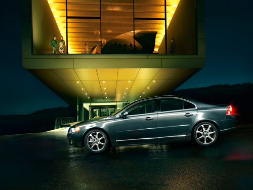
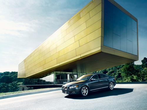
2008 - Volvo S80

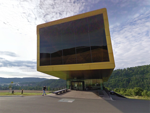
2008 – Volvo S80 at Arche Nebra – Die Himmelsscheibe erleben on An der Steinklöbe 16 in Nebra, Germany (photograpy by Anatol Kotte)

2008 - Volvo S80

2008 – Volvo S80 at Arche Nebra – Die Himmelsscheibe erleben on An der Steinklöbe 16 in Nebra, Germany 2008 (photograpy by Anatol Kotte)

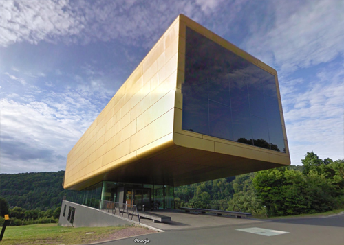
2017 – Arche Nebra on An der Steinklöbe in Nebra in Germany (Google Streetview)

2017 – Arche Nebra on An der Steinklöbe in Nebra in Germany (Google Streetview)

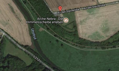
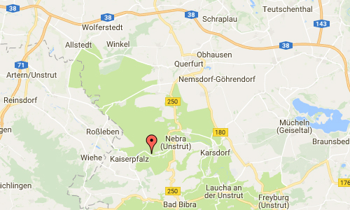
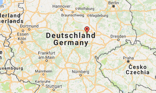
Arche Nebra or Die Himmelsscheibe erleben is a visitor centre located on An der Steinklöbe 16 in Nebra, Germany.

Nebra Ark is also known as The Sky Disc Experience. The Nebra Ark Visitor Centre takes you to the fascinating world of the Nebra Sky Disc. The visitor centre near the place of discovery of this unique treasure connects archaeology and astronomy and presents the exiting history of the famous bronze disk in an innovative interaction of scientific information and lively display. Core of the “Nebra Ark” is the planetarium. This show makes the complex knowledge encoded on the Nebra Sky Disk understandable.

The “Himmelsauge“(Sky eye) at the discovery place connects sky and earth exactly at the location at which the image of the sky lay undetected in the ground for 3.600 years. The lookout tower, 30 m high, allows views like at the bronze age and makes the bronze age astronomy comprehensible. A vertical section divides the building and marks the viewing axis to the “Harz massif” (A mountainous area) with the mountain Brocken. Also today it can still be observed, how the sun goes down behind this prominent landmark at the summer solstice, the longest day of the year.

More information at en.wikipedia.org, www.himmelswege.de and www.himmelsscheibe-erleben.de.

Thanks to Changyoung Jeong for finding this location!

Volvo Photography Locations