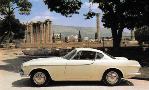
International Volvo Photo Locations Part 485


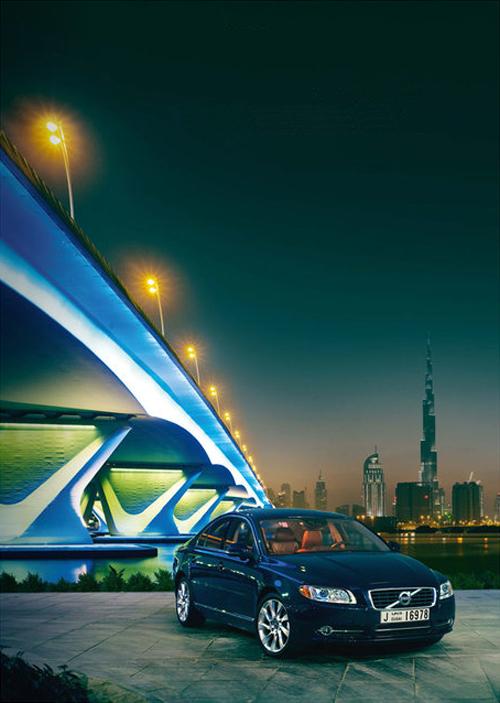
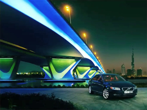
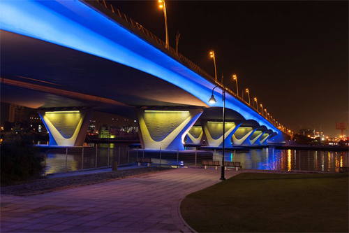
2015 – Volvo S80 at Marina Bay Sands and Sands Expo & Convention Centre near Bayfront Link and Marina Bay in Downtown Core Singapore 🇸🇬.
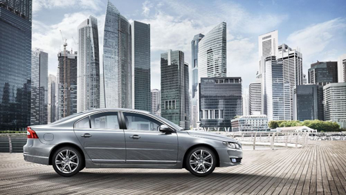
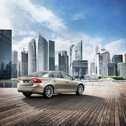
2016 – Volvo S80 at Marina Bay Sands and Sands Expo & Convention Centre near Bayfront Link and Marina Bay in Downtown Core Singapore 🇸🇬. Phtotography by Daniel Fortmann
2015 – Volvo S80 at Marina Bay Sands and Sands Expo & Convention Centre near Bayfront Link and Marina Bay in Downtown Core Singapore 🇸🇬.

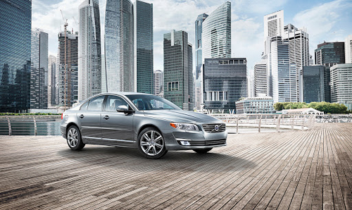
2015 – Volvo S80 at Marina Bay Sands and Sands Expo & Convention Centre near Bayfront Link and Marina Bay in Downtown Core Singapore 🇸🇬.
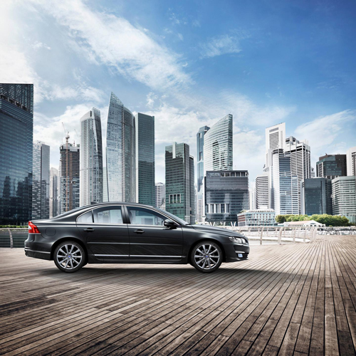
2015 – Volvo S80 at Marina Bay Sands and Sands Expo & Convention Centre near Bayfront Link and Marina Bay in Downtown Core Singapore 🇸🇬.
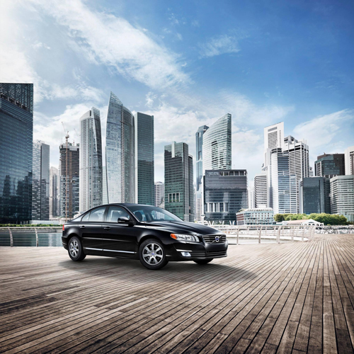
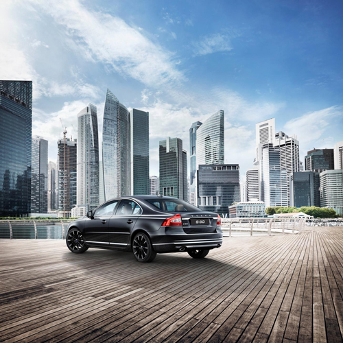
2015 – Volvo S80 Momentum at Marina Bay Sands and Sands Expo & Convention Centre near Bayfront Link and Marina Bay in Downtown Core Singapore 🇸🇬.
2014 – Volvo S60 at Marina Bay Sands and Sands Expo & Convention Centre near Bayfront Link and Marina Bay in Downtown Core Singapore 🇸🇬.
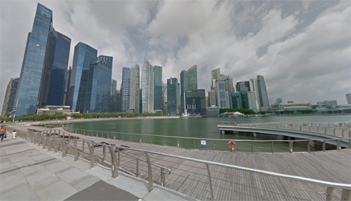
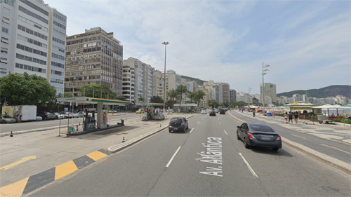
2022 – Marina Bay Sands and Sands Expo & Convention Centre in Downtown Core in Singapore (Google Streetview)
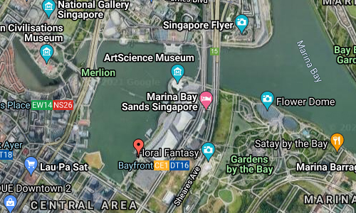
Marina Bay Sands is located at Marina Bay in Singapore.
It is an integrated resort fronting Marina Bay, owned by the Las Vegas Sands Corporation. At its opening in 2010, it was billed as the world’s most expensive standalone casino property at US$6.88 billion, including the land cost. The resort includes a 2,561-room hotel, a 120,000-square-metre convention-exhibition centre, the 74,000-square-metre The Shoppes at Marina Bay Sands mall, a museum, a large theatre, “celebrity chef” restaurants, two floating crystal pavilions, art-science exhibits, and the world’s largest atrium casino with 500 tables and 1,600 slot machines. The complex includes three towers topped by a connecting 340-metre-long SkyPark with a capacity of 3,902 people and a 150 m infinity swimming pool, set on top of the world’s largest public cantilevered platform, which overhangs the north tower by 66.5 m. The 20-hectare resort was designed by Moshe Safdie architects.
Singapore, officially the Republic of Singapore, is a sovereign island city-state in maritime Southeast Asia.
It lies about one degree of latitude (137 kilometres) north of the equator, off the southern tip of the Malay Peninsula, bordering the Straits of Malacca to the west, the Riau Islands (Indonesia) to the south, and the South China Sea to the east. The country’s territory is composed of one main island, 63 satellite islands and islets, and one outlying islet, the combined area of which has increased by 25% since the country’s independence as a result of extensive land reclamation projects.
It has the second greatest population density in the world. With a multicultural population and recognising the need to respect cultural identities, Singapore has four official languages; English, Malay, Mandarin, and Tamil. English is the lingua franca. Multiracialism is enshrined in the constitution and continues to shape national policies in education, housing, and politics.

More information at en.wikipedia.org/wiki/Marina_Bay_Sands and en.wikipedia.org/wiki/Singapore.


 Posts
Posts